
Raytown ZIP Code Coverage
Missouri's official city and county ZIP association table, dated November 15, 2025, associates Raytown in Jackson County with 64129, 64133, and 64138. That is the local postal baseline. It is not a street-by-street delivery map or a municipal-boundary map. The table below keeps the documented local examples separate from the USPS-service-area questions that were not answered by the available sources.
| ZIP Code | Areas Covered | Post Office | Notes |
|---|---|---|---|
| 64133 | Central Raytown, including City Hall and 63rd Street city-line examples | Raytown Post Office, 10501 E 63rd St, Raytown, MO 64133-9998 | Official Missouri table associates it with Raytown; verify delivery by address |
| 64138 | Raytown Road and southeastern or eastern Raytown-area references | Longview Post Office, 8800 Raytown Rd, Kansas City, MO 64138-9998 | Official packets use both Raytown and Kansas City postal labels; check each address |
| 64129 | Official Missouri table associates it with Raytown; planning material shows nearby Kansas City postal examples | Exact USPS station and service-area assignment was not located | ZIP or postal city alone does not prove the Raytown city boundary |
The Missouri ZIP association table supports the three-ZIP set, while USPS location records confirm the central Raytown and Longview station addresses. No official station-to-service-area map was located for every Raytown address or for all of 64129. Keep that gap visible rather than assigning a station by assumption.
The Raytown station record displays weekday, Saturday, and Sunday hours for the 64133 location. The Longview station record uses the Kansas City city line for its 64138 address. Those records establish station details, but they do not map every Raytown delivery address to a station.
Raytown USPS ZIP Code Checks
The USPS ZIP Code Lookup is the final format check for a particular delivery address. Its documented modes are By Address, By City and State, and Cities by ZIP Code. In address mode, Company is optional, Street Address is required, Apt/Suite/Other is optional, and the form also asks for City, State, and ZIP. USPS advises adding a unit or company when multiple matches appear. A match does not confirm that a named person or company is at the address.
The USPS lookup presents the delivery-address and city-to-ZIP routes used for postal verification.
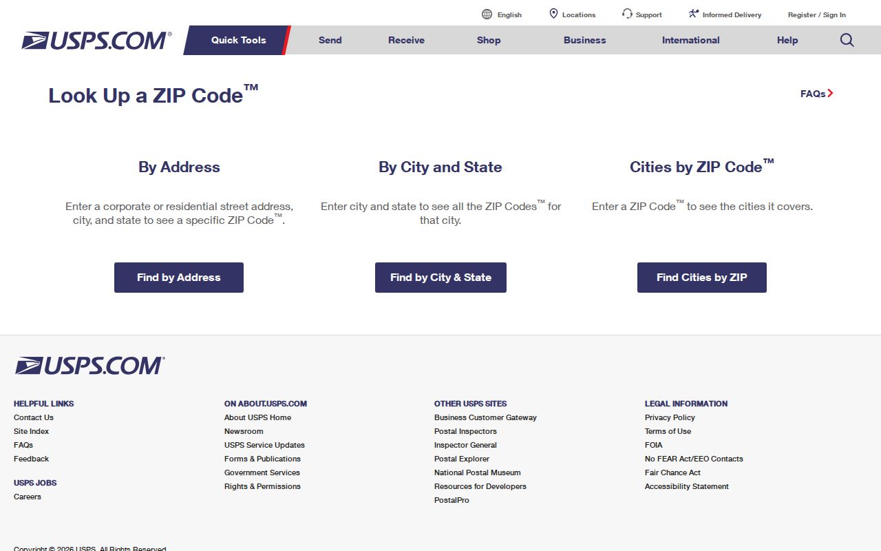
Record the result date and compare the returned delivery format with the address as it appears in county or city records. That comparison is especially important when a Raytown-area address carries a Kansas City postal city line.
| USPS ZIP code mode | Fields or inputs | Use for a Raytown question |
|---|---|---|
| By Address | Street Address, City, State, ZIP; optional Company and unit | Confirm delivery formatting for one complete address |
| By City and State | City and state search | Check postal associations without treating them as city limits |
| Cities by ZIP Code | ZIP code search | Check a ZIP-to-city question, then preserve the result date |
Raytown ZIP Code Search Fields
ZIP-wide resident searches were not documented in the local county and state paths. The Jackson County Collector tax search accepts a PIN, primary owner, property address, or mailing address, but its reviewed instructions do not expose a dedicated ZIP filter. The county Public Property Portal says it can search real and personal property by address, parcel ID, and other methods, yet the live ZIP behavior was unavailable during review. The Property Info App accepts an address or parcel search rather than a documented ZIP search.
| Raytown-area portal | Documented fields or route | ZIP code limitation |
|---|---|---|
| County Tax Search | PIN, Primary Owner, Property Address, Mailing Address; wildcard accepted | No dedicated ZIP filter documented; returns up to 200 results |
| Public Property Portal | Address, parcel ID, and other county-described methods | Live field and ZIP behavior unavailable during maintenance |
| Property Info App | Address or parcel search and property tools | ZIP search mode was not documented |
| Missouri voter lookup | Registered name, date of birth, last four SSN digits, and county | Exact-data lookup, not a documented ZIP-wide resident list |
That limitation matters. USPS confirms a delivery format for one address. County GIS and assessment tools confirm parcel context. Neither creates a verified directory of people throughout a Raytown ZIP code.
Raytown ZIP Code Parcel Checks
After USPS confirms the delivery format, use the Jackson County GIS Parcel Viewer for the parcel layer. It accepts an address or parcel number, permits parcel clicks and map-layer review, and can show the parcel number, address, lot size, building information, land-use code, tax code area, exemption, districts, legal description, values, and owner fields. The county Property Info App repeats the address-or-parcel route and adds owner, mailing, district, and elected-official categories.
These records answer a different question from USPS. A parcel number and legal description identify county land records. A situs address identifies the property, while a mailing address identifies where the record is sent. Neither field proves a person receives mail at the property or lives there. If a Raytown record includes a ZIP, keep it alongside the source's city line and the retrieval date instead of replacing the source address with a normalized version.
GIS instructions also say to search a multiple-parcel address by parcel number, map click, or the specific returned address. That is useful when a ZIP-level question becomes a single-property question. It does not create a documented ZIP-wide parcel or resident search.
Find Raytown Records by ZIP Code
A Raytown ZIP code directory narrows the geographic question, but it does not replace an address or identity search. Begin with USPS when the delivery label is uncertain. Move to a county property tool only after an address or parcel has been identified. When a particular person's registration needs confirmation, the state voter lookup asks for exact data and a county selection. It is not designed to return every person in a ZIP.
- Use USPS By Address for a full delivery address, or use the city-and-state and cities-by-ZIP modes for a postal association question.
- Save the returned city line, ZIP, unit information, and result date without treating the postal city as the municipal boundary.
- Search Jackson County GIS, Property Info, or tax tools by the verified address or parcel number, because a dedicated county ZIP filter was not documented.
- For a known individual, use the Missouri voter route with exact registered identity information and Jackson County, subject to protected-address rules.
- Compare the parcel's legal description, situs address, and mailing address before describing the Raytown location.
Once a ZIP question leads to a complete address, the Raytown street directory gives the county parcel-to-deed sequence for that single property. A ZIP label alone is not enough for that chain.
Raytown Postal City Geography
ZIP codes are delivery constructs. Raytown is not interchangeable with every address whose postal city line says Raytown, and a Raytown-area delivery point can show Kansas City. The Longview Post Office record at 8800 Raytown Rd uses Kansas City, MO 64138-9998 even though 64138 is associated with the Raytown area in local material. This is a postal-city difference, not evidence that the address is outside Raytown or inside it. The city line, parcel, and delivery address each answer a different geographic question.
The Census profile also shows ZCTA geography intersecting 64133, 64138, 64055, and 64129. A ZCTA is a Census tabulation area, not a USPS assignment. Its intersection with Raytown does not prove that 64055 serves the city or that an individual address has that ZIP. Count 64055 as an overlap clue only, not as a fourth confirmed Raytown ZIP code.
Raytown ZIP Code History Gaps
No official ZIP split or realignment year for Raytown was located in the reviewed sources. No citywide E911 readdressing project was located either. That absence should not become a claim that no change ever occurred. It means a dated address should be checked against the postal result, county parcel record, and any city planning or historical source that fits the time period.
Road history can add another term to the search. Local material documents that 63rd Street was widened in 1911 into Blue Ridge Boulevard and later again commonly called 63rd Street. This is a street-name check, not a documented ZIP change. For a historic address, retain both the old and current road labels alongside the city line and ZIP.
Raytown ZIP Code Boundary Limits
A Raytown ZIP code directory is a postal reference, not a city-limit record or a people list. Postal delivery may cross municipal lines. A parcel can carry a situs address, a different mailing address, and a legal description that does not mirror its USPS wording. The county tax instructions do not document a ZIP control, the property portal's live ZIP behavior was unavailable, and the voter lookup works from county and exact registration data. Use the ZIP as one field in a dated address record, not as a conclusion about city residence.
- ZIP code
- The postal code used to route delivery for an address or postal area. It is not a municipal boundary.
- ZIP+4
- An added four-digit delivery detail used with the five-digit ZIP code for a more specific mailing segment.
- PO Box ZIP
- A postal code used for post office boxes. No Raytown PO Box ZIP assignment was verified in the reviewed sources.
- Unique ZIP
- A ZIP assigned to one organization or destination. No Raytown unique ZIP was verified in the reviewed sources.
- Carrier route
- A delivery-route grouping. It should not be treated as a city district or a list of people.
When city limits matter, compare the municipal record or planning context with the parcel record. When delivery format matters, return to USPS. When a person must be verified, use the custodian whose record is tied to that person and respect protected-address rules.