
Search a Raytown Street Address
A Raytown street directory search works best as a chain, not as a claim about occupants. Start with the exact address. The county parcel tools can identify the parcel and display owner and mailing fields. Next, compare a recorded instrument against that parcel's legal description. Only after a specific identity is in hand should the Missouri voter route be used, and it requires exact registration data rather than a street-wide roster. For older clues, take the address, former road names, and date to historical directory and local-history collections. Each step answers a narrower question and leaves the relationship named by the source intact.
- Enter the address in the Jackson County property or GIS route and preserve the returned address and parcel number exactly.
- Use the owner fields as assessment information, then compare the situs and mailing addresses instead of treating either as proof of present occupancy.
- Search the Recorder's grantor and grantee index with the owner name and cross-check the legal description, subdivision, or lot and block.
- For a particular person, use the Missouri voter lookup with the registered name and exact identity fields, or ask the Jackson County Election Board about a lawful record request.
- For a historic address, search former street labels and consult the Midwest Genealogy Center or local-history holdings for dated directory clues.
That order keeps a Raytown by-address search anchored to the record type. A deed shows a recorded transaction. An assessment card is not a certified deed, and neither record confirms who is currently inside a property.
Raytown Street Parcel Viewer
The Jackson County GIS Parcel Viewer accepts an address or parcel number. After a parcel is selected, its panel can expose the parcel number, address, lot size, building information, land-use code, tax code area, exemption, districts, legal description, values, and owner fields. The map also supports parcel clicks, layers, measuring, printing, and PDF export. These are strong tools for comparing a run of parcels on a Raytown street, but a formal radius or buffer search was not confirmed. Parcel clicks provide map context, not a complete list of people nearby.
The parcel viewer begins with instructions and a property-information route before an address search is run.
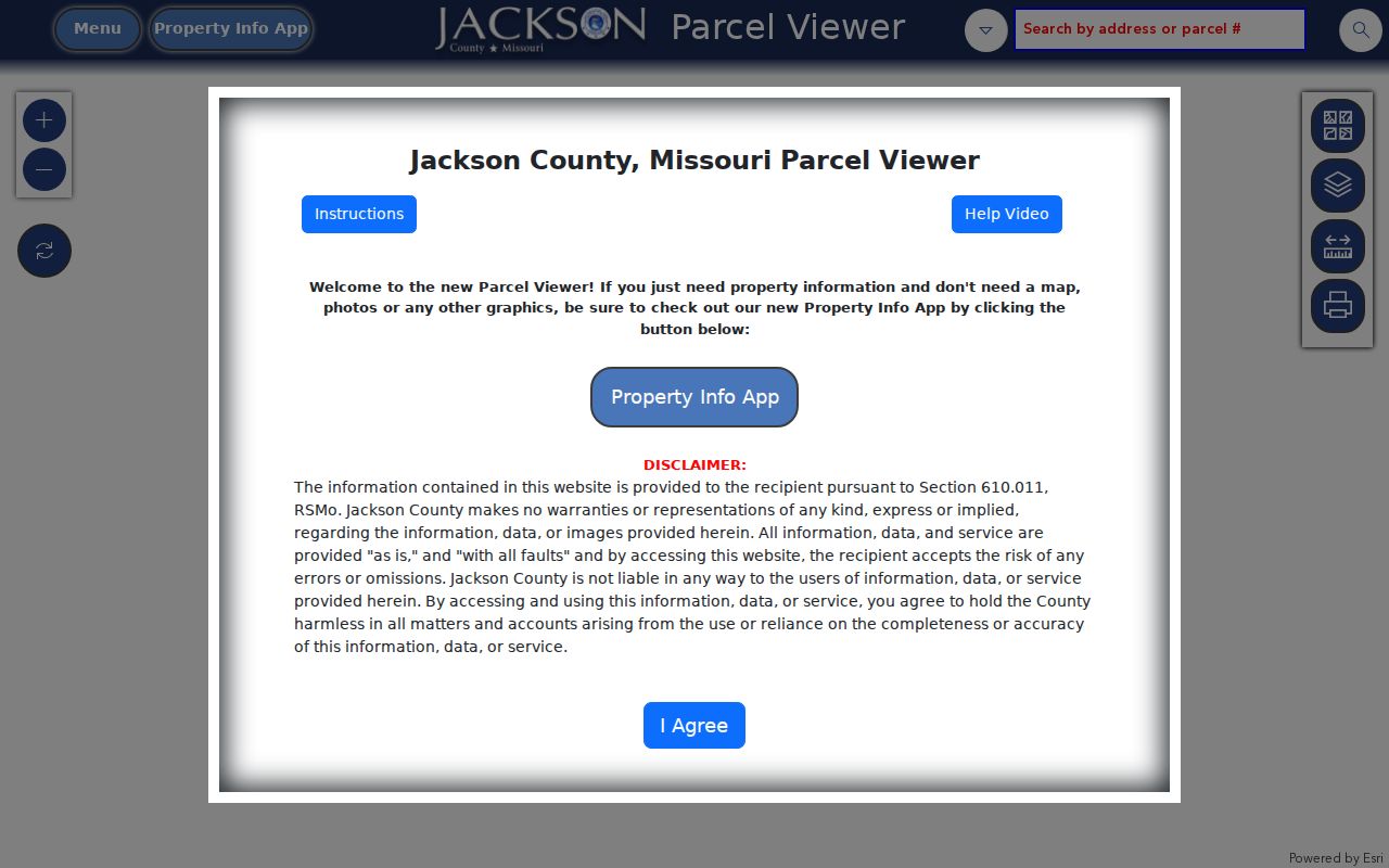
Use the selected parcel's number and legal description when moving from the map to another Raytown street record. The panel's owner and value fields remain assessment and GIS information.
| Raytown street tool | Observed search or control | What the result can show |
|---|---|---|
| GIS Parcel Viewer | Address or parcel number, parcel click, map layers | Parcel, address, lot, land use, districts, legal description, values, and owners |
| Property Info App | Address or parcel search and Search control | Property, ownership, district, value, and elected-official categories |
| Public Property Portal | County documents address, parcel ID, and other methods | Real and personal-property routes; live field details were unavailable during maintenance |
Raytown Street Formats and Parcels
For a Raytown address, retain the source version first, then separate the house number, directional prefix, street name, suffix, directional suffix, unit, city line, state, and ZIP. GIS instructions use a house number, direction, street name, direction, city, and ZIP format. They say not to add the state or punctuation after a street or directional, to use standard street-type abbreviations, and to enter digits one at a time while suggestions load. If several parcels match, search by parcel number, click the map parcel, or choose the returned address that fits the record.
Parcel formats require extra care. One county GIS instruction gives a dashed format of 00-000-00-0-00-0-00-000, while another county property-information source describes 17 digits. Those official descriptions conflict. Use the format accepted by the specific tool, then copy the returned parcel number instead of guessing its length.
- Parcel
- A defined piece of land in the county assessment and mapping system, identified by a parcel number.
- Situs address
- The address assigned to the property itself. It may differ from an owner's mailing address.
- Plat
- A recorded map that can show a subdivision, lots, blocks, roads, and parcel relationships.
- Legal description
- The land description used in property records, which is more stable than a postal city line or street label.
Note: Keep the postal city, municipal context, parcel number, and date observed as separate fields when comparing Raytown street records.
Raytown Street Deed Chain
The Jackson County Recorder's Aumentum portal provides Grantor and Grantee lists, a Search Real Estate Index, and a Subdivision List. The recorder describes online recorded documents from roughly the early 1960s forward, while plats reach back to 1826 and earlier or non-digitized items may require microfilm. A grantor transfers or gives an interest named in an instrument; a grantee receives it. Neither label means the person was a resident at the address.
The Aumentum public-records portal is the source route for the recorder's real-estate index and recorded-document search.
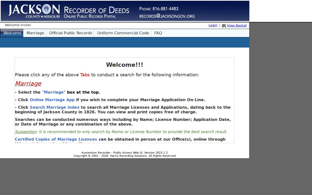
Match the instrument against the GIS parcel number and legal description before placing it in a Raytown deed chain. When an online result ends at the early-1960s horizon, the recorder's microfilm and older materials are the documented next channel.
Recorded land files cover more than deeds. The Recorder describes deeds of trust, mortgages, assignments, releases, liens, affidavits, agreements, judgments, powers of attorney, wills, and many other instruments. Read the instrument type and recording date. Do not turn a deed event into an occupancy conclusion.
Raytown Street Sales Search
The Jackson County Real Estate Sales Search offers another address-focused route. It has a Parcel Number Search field that accepts a partial match when incomplete and states a dashed parcel pattern of XX-XXX-XX-XX-XX-X-XX-XXX. A separate owner and property search exposes Owner Name, House Number, and Street Name. Owner searches use last name first, company names may be full or partial, and the street-name instruction says to leave out directional prefixes and suffixes. House number requires a street name.
A sale-information checkbox can narrow that search to properties with sale information. The available controls include Home, New Search, and Search. Result sorting, pagination, and export behavior were not documented, so the returned screen should be treated as a search result rather than an exhaustive street inventory. Its value is in testing an owner, house number, street name, or parcel against the other county records already found.
When a sale result and an assessment card disagree, preserve both records with their date and source. The county distinguishes market, assessed, and taxable values, and a sale reference is not interchangeable with any of those value fields.
Raytown Street Tax Accounts
The Jackson County tax search accepts a PIN, primary owner, property address, or mailing address. Its instructions set a 200-result maximum, use a 24-digit dashed PIN for real property and nine digits without dashes for personal property, and allow an asterisk as a wildcard. Spelling out street names and using fewer terms can help when a search is too narrow. A dedicated ZIP filter was not documented, so do not describe the tax tool as a ZIP-wide Raytown directory.
The tax search form displays its property-address and mailing-address routes before results are requested.
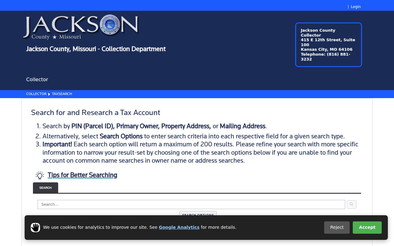
Tax results can help compare a property address with a mailing address, but those labels should not be collapsed into a statement about who lives at a Raytown address.
Raytown Street Records by Custodian
A street directory is most reliable when each result is labeled by its keeper. Jackson County holds the parcel, assessment, tax, and recorder layers. Raytown holds municipal records that may need a request rather than a public search. The Missouri voter route is an exact-identity check, not a block list. The table distinguishes the address key from the fact a record can actually support.
| Raytown address record | Custodian | What it identifies | Documented access |
|---|---|---|---|
| Assessment card and GIS parcel | Jackson County | Owner fields, mailing and situs addresses, values, land and building data, districts | Public Property Portal, Property Info App, and GIS viewer; not certified |
| Tax account | Jackson County Collector | PIN, primary owner, property address, mailing address, and tax-search results | Public address or PIN search, with a 200-result maximum |
| Recorded instrument and plat | Jackson County Recorder | Grantor, grantee, instrument date, legal description, lot and block | Online index roughly from the early 1960s; older materials or plats may need microfilm |
| Voter registration record | Missouri and Jackson County Election Board | Specified public registration fields, subject to protected-address rules | Exact-data state lookup or ask the Election Board for lawful procedure |
| City planning, permit, or code record | Raytown Community Development or City Clerk | Address, public action, project, plan, or record description | City route or Missouri Sunshine request; historic search coverage was not verified |
The parcel number and legal description are the strongest cross-custodian bridge. The street name is useful for finding a starting point, but it changes more often than a legal description. For voter material, Missouri law lists public fields and protected-address exceptions, while the online lookup itself asks for exact identifying data.
Raytown Street Names and City Lines
Raytown street research has two geography traps. Postal city lines do not always match municipal boundaries, and a road may appear under an earlier name. Local history records that 63rd Street was widened in 1911 to become Blue Ridge Boulevard and later again commonly appeared as 63rd Street. A historical hit may therefore need searches for 63rd Street, Blue Ridge Boulevard, Blue Ridge Cutoff, Raytown Road, an intersection, a school, a cemetery, a landowner, or a rural county description.
Postal labels can differ too. Raytown-area planning records include Raytown and Kansas City city lines with ZIP codes 64133, 64138, and 64129, and some parcels have no city-assigned address. Confirm the delivery format with the USPS ZIP lookup, then use the county GIS and parcel record to check the legal parcel. A postal label should never be silently converted into a municipal-boundary finding.
For a narrower delivery-area question, the Raytown ZIP Code Directory separates the three official Missouri ZIP associations from Census ZCTA overlap and postal-city wording.
Raytown City Address Records
The City Clerk is the municipal records custodian for official city records, agendas and minutes, ordinances and resolutions, certifications, and public-record requests. The Clerk's page links the Sunshine Records Request Form, while city forms and Community Development materials provide the address-level route for plans, permits, and code matters. Request a defined record by address, date range, project, ordinance, or case description. The city route does not provide a personal-profile search service.
Retention matters. The city schedule says a Street Address Log, Street Information Card, or Street Number Locator Book may be destroyed when superseded or no longer needed. Building-code inspection and enforcement files may be kept for five years, or five years after defects are corrected. A missing city file can mean a different custodian or a retention event, not proof that nothing occurred.
Note: City-held records without a public index are best requested through the Clerk or Community Development with a precise address and date range.
Raytown Street Directory Limits
No Raytown street directory can establish a full household. A parcel map shows parcels and assessment fields, not occupants. A deed records a transaction, not a person's routine or continuous residence. The voter lookup is exact-data based, and protected residential addresses may be closed. County property tools also distinguish situs and mailing addresses, so an owner field or mailing line must not be presented as a current-resident claim.
Use a second attribute before accepting a match. Compare the address, date, parcel number, legal description, instrument type, and the relationship shown by the record. The county property portal warns against mining, gathering, or extracting its data, and recorder data is not warranted as complete or reliable. Where a legal conclusion depends on a document, obtain the underlying image or a certified copy from the custodian.
Lawful use. Use Raytown address records for personal, lawful research and stop at the public record. Do not compile routines, protected locations, relatives, or multiple current locations, and never use records to stalk, harass, or harm anyone.